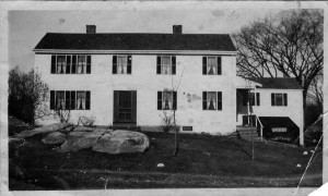
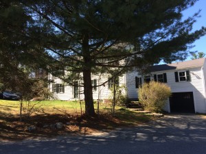
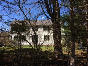
I mentioned in this post here that my parent’s had found some old photos that Alice Koford had taken and given them in the late 1960’s when they purchased the property on South Street in Carlisle. The photos were taken post WWII but before the property was sold in the estate sale (as I recall, Alice’s mother passed away in 1941 without a will and the siblings were unable to work out the details for over 20 years – so the judge moved the estate into an estate sale. Ben Benfield outbid Alice by some $15,000 for the full 150 acres and the house. He broke up the property and sold the house and 5 acres to Alice, 5 acres to my parent’s and the remainder went into various conservation restrictions. Some was sold to the newly formed Conservation Foundation (between our property and the Concord town line and Spencer Brook) and across Westford road up the hill along West Street – a conservation restriction)
Anyway – yesterday (Saturday) I took a camera tried to replicate the pictures as of present day. That turned out to be a bit of a challenge for two reasons – first, that the apparent aspect ratio and lens field of view that Alice used was a bit different than what I have today. I got pretty close though. Secondly – traffic on a Saturday here is now significantly different than back then – standing in the middle of the street takes a bit more situational awareness and agility than I suspect that Alice needed to use during the first shots! (for my brothers, this should be obvious, since we used to play up and around the street and the traffic in the ’70’s was pretty meagre compared today – and that had to be 20+ years after the original photos were taken.
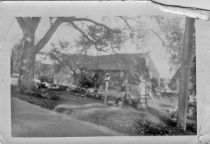
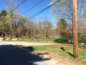
So – first up – the original picture of the barn at the top of our present driveway. Note a couple of things
- The large elm tree on the left of the original picture was still alive when the property was purchased. My mom says that all the elms on the property (4 large ones) all became stricken with Dutch Elm disease shortly there after and died. The future stump of the elm became the left hand corner of our present drive way (give or take) – I recall it making left turns out of the driveway onto South Street to be a bit of a hassle.
- Some rocks in the stone wall are recognizable from both pictures
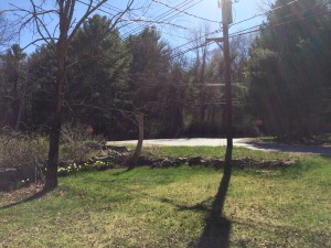
- It is unclear if the telephone pole in the photos is the same pole or not? I am pretty sure it is NOT because the square relief cut on the earlier photo appears to be missing on the current pole. So it is difficult to figure out the distances from the edge of the road on that side. I seem to recall as a teen, that South Street was lower vs the grass than either photos show – because mowing around the pole was a bit tricky due to height differences. Not sure how much that was or accurate that memory is
- the corner of the main stone wall currently is a 12’x12′ approximate square arrangement of stones. It is difficult to say if that is present or not?
- The barn was gone when my parents bought the property. My mom had the driveway guys fill in the cellar hole and foundation of the barn so we little kids would not fall into it.
- on the right hand side of the older picture is a hen house type structure (long and narrow and parallel to the present driveway. My Mom recalls it containing a large stack of Wellesey College Alumni magazines along with other trash. Everyone at the time thought that was very odd.
- New Picture stuff – the big tan rock? that was buried and in the town ‘taking’ along the road and was a regular obstacle to snow plows and cars hitting it and breaking things – the town got sick of it sticking up so they pulled it out. My dad convinced them to just move it onto our property since it was neat.
- New Picture – Additional. This shows the backside of the area around the telephone pole because the squared stone work is not very visible in my current photo.
The old Koford House, previous prior to that, the old Davis House. Read more from the Wilkins Books online at the Gleason Public Library website for descriptions of this house that dates back to 1689 and other old houses in Carlisle, MA
A few things to note between old and new.
- Alice Koford told me that she planted a number of the trees along South Street and at the corner when she was a kid to block noise from the chickens that were on the old Hutchinsons/Larson’s property (next to our parent’s property)
- Simon Davis Jr. built the house originally. John Davis lived there and practiced medicine. Samuel Davis lived there for some time. It appears that the Hutchinson’s owned it briefly (based on map). This was sold to William Farrar (son of Steven Farrar and Lucy Davis) and the Hutchinson’s had the house next door (Spencer Brook Farm). The deeds and documentation are a bit vague. Ultimately, it was sold in 188o’s to William C Koford.
