Travel dates June 2015

Hi everyone – I will be travelling to and from Boston/SFO on the following dates.  I have a work event on the weekend while in SFO – department picnic on Sunday June 7th at Quarry Lake in Fremont. Boston to SFO Date: 04Jun2015   (this is a Thursday) Flight: VX353 Depart: 04:30PM Arrive: 08:05PM San … Continue reading “Travel dates June 2015”

Hi everyone –

I will be travelling to and from Boston/SFO on the following dates.  I have a work event on the weekend while in SFO – department picnic on Sunday June 7th at Quarry Lake in Fremont.

Boston to SFO Date: 04Jun2015   (this is a Thursday)
Flight: VX353
Depart: 04:30PM
Arrive: 08:05PM

San Francisco CA (SFO) to Boston MA (BOS)  (this is a Friday)
Date: 12Jun2015
Flight: VX352
Depart: 09:15AM
Arrive: 06:05PM

Marking out the house foundation and rock – LOTS of rock!

The prep stage for any project always seems longest – but it is where a project is made or broken.  This past week or so the foundation was marked out at my house site and then the last of the topsoil was removed – bringing forth a dome of rock ledge right below the surface … Continue reading “Marking out the house foundation and rock – LOTS of rock!”

The prep stage for any project always seems longest – but it is where a project is made or broken.  This past week or so the foundation was marked out at my house site and then the last of the topsoil was removed – bringing forth a dome of rock ledge right below the surface across a very large portion of the site.  We had suspected that this would be the case by looking at the geology and folds of the ground when I first bought the property.  That was a major thought process in my head when I decided to go with concrete piers and elevate the house – instead of a conventional basement.  Go with the site instead of fight it.

My dad and I were over this weekend looking at the site and it has definitely changed.  The entire hill area was rock ledge under a narrow coating of sandy topsoil – that soil has now been removed as of this weekend.  The rock ledge humps up out of the ground at the common driveway, dissappears (where I put my septic system) and then reappears where the house is going to be (all the photos in this post), dissappears for about 20′ and then reappears and meets up with pages brook.  There probably was a natural small waterfall on the site in colonial times and was the reason that a mill was established so early in the town’s history (1660 actually being very early in the Massachusetts Bay Colony history since Boston was founded in 1630).

My dad did some research and we think this a portion of the Gneiss that makes up the local Nashoba/Shawsheen or Fish Brook Gneiss formation(s) in the local area.  The literature on the geology around here seems to spend at least 1/2 the time talking about which geologist has name rights – lol.  Gneiss is a metamorphic igneous rock (ie – from the mantle/core instead of laid down like sandstone or limestone) and according to the blasting folks, the species in Carlsle is HARD  (ie – shaping it with explosives is more expensive than normal).  It is also extremely interesting looking up close and the “banding” at my site is very, very interesting.  Gneiss on Wikipedia – look to the section on Scotland for the banding that is similar to my site.  Hopefully things will be easier to photograph when the site is cleaned up or I will do a false color overlay.

On to the pictures!

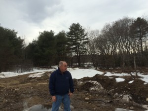
March 2014 view of the rock ledge under the knoll at my house. Pictures in May 2015 after fully excavating the site show that it is an enormous bubble of rock covering most of the site. The plan to mount and anchor the house on concrete piers pinned to the rock is turning out to have been a great idea
March 2015 view of the rock ledge under the knoll at my house. Pictures in May 2015 after fully excavating the site show that it is an enormous bubble of rock covering most of the site. The plan to mount and anchor the house on concrete piers pinned to the rock is turning out to have been a great idea
March 2015 looking from the knoll, back over the septic field with driveway starting from the left side of my dad and curving around to the right (behind him). This area turns out to be 100% rock ledge under us
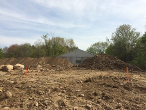
Dirt that has since been moved - note the orange stakes - this is where in the other photo the orange painted rocks are
Dirt that has since been moved – note the orange stakes – this is where in the other photo the orange painted rocks are
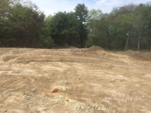
All rock ledge under there - tremendously difficult to photograph properly - but all the 'scrapey' areas are sheer rock with a fine layer of dust on them. The rocks with orange paint on them are the locations where orange stakes used to be - corners of the foundation locations
All rock ledge under there – tremendously difficult to photograph properly – but all the ‘scrapey’ areas are sheer rock with a fine layer of dust on them. The rocks with orange paint on them are the locations where orange stakes used to be – corners of the foundation locations
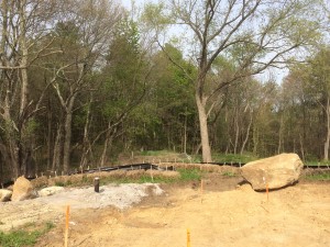
The dark iron pipe is the well head for the standing water column geothermal well (providing both heating/cooling and drinking water - 600' depth. The big rock was moved out of the way from where I am standing as the engineering firm of Stamski & McNary laid out the locations for the concrete piers for the house. Contrast to one week latter
The dark iron pipe is the well head for the standing water column geothermal well (providing both heating/cooling and drinking water – 600′ depth. The big rock was moved out of the way from where I am standing as the engineering firm of Stamski & McNary laid out the locations for the concrete piers for the house. Contrast to one week latter

Note – in the photo above of the well head – directly behind this on the other side of the silt retention hay bale retention system is the rock ledge over by the old dam.  When I bought the property, this rock ledge was the only rock exposed.  We guessed the rest of the rock system was there by the lay of the land and my Dad using some of his archaeology tool kit to probe under the topsoil (ie – hammer steel rods down in a grid pattern and see when/if you strike something.  He did and it was pretty consistent, so we assumed rock – 100% on the money!!)

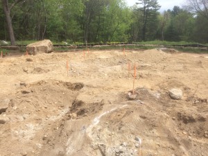
More footings locations - after removal of the last layer of soil - in the foreground is rock
More footings locations – after removal of the last layer of soil – in the foreground is rock
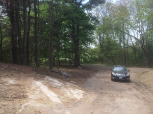
Rock ledge emerging from the hillside as you come up the driveway. The plan is to leave this undisturbed and curve the drive around this outcropping. In person it is super interesting looking with wide streaks of light and dark stone (a bit covered up at the moment). Lots of rock on this site :-)
Rock ledge emerging from the hillside as you come up the driveway. The plan is to leave this undisturbed and curve the drive around this outcropping. In person it is super interesting looking with wide streaks of light and dark stone (a bit covered up at the moment). Lots of rock on this site 🙂
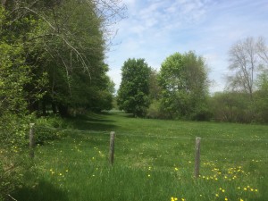
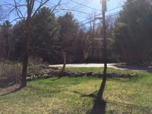
And now for something completely different (to steal a phrase from Monty Python). Part of the communal conservation land at my house. This was taken looking north from the footpath along Bedford road, about 50' to the left of my common drive. If you read my post on the old mill operation at my property ( http://sixthelement.org/wordpress1/2015/05/03/carlisle-saw-mill-pages-brook-historical-start/ ) ? this area here is part of the field complex that would be flooded in winter and folks used to ice skate on the flooded area.
And now for something completely different (to steal a phrase from Monty Python). Part of the communal conservation land at my house. This was taken looking north from the footpath along Bedford road, about 50′ to the left of my common drive.
If you read my post on the old mill operation at my property – this area here is part of the field complex that would be flooded in winter and folks used to ice skate on the flooded area.


Carlisle Saw Mill, Pages Brook – historical start

I was reading the excellent Carlisle:  Its History and Heritage by Ruth Chamberlin Wilkins and came across the founding of the mill on my property on Bedford Road, Carlisle.  I have excerpted it below by hand. Product Details (Amazon.com)  Unknown Binding: 481 pages Publisher: Carlisle Historical Society; 1st edition (1976) Language: English ASIN: B0006CO8UA Page … Continue reading “Carlisle Saw Mill, Pages Brook – historical start”

I was reading the excellent Carlisle:  Its History and Heritage by Ruth Chamberlin Wilkins and came across the founding of the mill on my property on Bedford Road, Carlisle.  I have excerpted it below by hand.

Product Details (Amazon.com) 

  • Unknown Binding: 481 pages
  • Publisher: Carlisle Historical Society; 1st edition (1976)
  • Language: English
  • ASIN: B0006CO8UA

Page 28

“Robert Blood had a sawmill in 1660 on Ministerial Brook, on land now owned by Richard B. Bates, 341 Bedford Road.  [the mill site now owned by me – Nicholas Fohl –  with the main Bates property belonging to the Kimball family who continue to operate the Bates – now Kimball’s Ice Cream stand].  John Green, who bought the property in 1736, continued to operate a mill there, as did still later generations of the Green family.  In the late 1800’s, Mr Benjamin F. Blaisdell ran a saw and hoop mill there.  He died in 1901, but the mill was operated as late as January 31st, 1903.  At that time, the mill, then operated by Edgar I. Blaisdell, was burned by a fire which started from a small stove during the lunch hour, when the men were away.  Probably not many remember the mill when it was in operation.  However, there are those now who remember skating on the then widely flooded meadows back of the mill, an area which at that time extended to East Street.”


She lists several mills throughout town on Spencer Brook, Concord Street, Great Brook, Lowell Street, East Street and Page Brook (on Brook and Maple streets).  I had never seen prior to reading this passage that Page’s Brook at my location also had the name of Ministerial Brook – interesting.

On the operation of mills

Page 220

“One of the earliest mills in town was the one located on the Great Brook on Lowell Street at the foot of the hill beyond the Farnham Smith residence (now Great Brook State Park) which had been the site of the fulling mill in the area for the finishing of homespun cloth.  Following that, its use was continued for other purposes.  In 1840, Henry Hoar had a Wheelwright and Paint Shop there, and after his death in 1842, William Green continued it for the same use.

The next owner, Mr. Elmon B. Rose, remodeled the shop for a hoop mill where he made birch hoops, nail kegs and similar products.  This shop burned in the fall of 1883.  In January of 1884, the following news item told of its being rebuilt: ‘A new hoop factory has been erected by Mr. Elmon Rose near the site of the one recently burned.  The next day after the fire, and while the old ruins were yet smouldering and smoking, the batters were placed in position for the new building, which has been gradually progressing day by day, and in less than a month after the fire, a building of about the same dimensions as the one burned, was completed and the accustomed vocation was being pursued.”

The following quotation about the hoop mills is taken from written recollections of the late James Harry Wilkins, who remembered the mills as a you boy, and particularly that of his uncle, Elmon B. Rose.  ‘In the Eighties and Nineties (1880s, 1890’s) there were four hoop mills in town.  One was on Lowell Street, owned and operated by Elmon Rose and situated at the foot of the hill near the residence of Farnham Smith [at No. 886].  Another on Lowell Street was near the home of Clinton Lahm [at No. 639]  One on Concord Street near Miss Macone’s new house [at No. 896]   and a fourth was on the property of Richard Bates, Bedford Road [at No. 341] , then owned by Benjamin Blaisdell, Sr.

“As the operation of the mills was much the same, the Rose mill on Lowell Road will be used to show how the hoops were made.  A crew of six or eight men were employed.  A part of the crew worked in the woods, cutting the birch poles and getting them to the mill, where three or four men, including the sawyer, work at the mill.  The six or eight horses that were needed to carry on the business of getting the poles from the wood and hauling the hoops to market were stabled in the large barn on the Farnham Smith property, a barn which was built by Mr. Rose.  Previous to acquiring this property, Mr. Rose had lived in a house formerly on the William Palmer place next door, [now the David F. Kitrosser place at 788 Lowell Street] and had used the barn which was then there.

“The poles were unloaded in the mill yard as near as possible to the outside saw that was used to cut the poles into proper lengths before going into the mill.  Inside they would be knotted and made ready for the hoop saw which was a concave saw about the size of an ordinary saucer.  The saw was concaved to allow the sawyer to get around irregularities in the poles.  Extra long hoops required two men, the sawyer and his assistant who stood at the opposite end of the saw bench to pull it through.  When the hoops came off the saw bench they were placed in a rack for bundling, and were made ready for market.

“The product of the Carlisle hoop industry was used largely by the meat packing plants in Somerville, and by the orange growers in Florida, but the use of wire and other forms of metal sounded the death knell of an industry that had meant much to the town down through the years.”

The following advertisement shows that the hoops from the Rose mill were also used for shoe boxes.  On February 22, 1889, an advertisement in the publication called “The Shoe and Leather Reporter” said, “E.B. Rose & Son, of Carlisle, Mass., manufacture strapping hoops for shoe boxes.  When nine feet and over in length, these straps cost at the rate of $1 for each 1,000 feet”

Mr. Rose’s hoop mill, after being abandoned for some years, collapsed in the fall of 1835, and eventually all traces of it were removed.”


My thinking about the prep of the birch and “would be knotted”?  I think what would happen is that the birch would be taken down out in the woods and the branches roughly trimmed on the site.  That would allow for a fairly easy transport and handling for the “outside saw” which trimmed for length.  Once inside, they would more carefully trim the branch stubs off the main trunk?  Interesting stuff and the only explanation of how a hoop mill operated that I have been able to find.

Carlisle Massachusetts, Wilkins Notebooks and old photos

I did a bit of digging for my prior post and when I Google searched for William Koford, I stumbled on the DigitalCommonwealth website.  It is wonderful and pretty well organized considering it appears to be structured via an automated process. Here is a search of photographs of Carlisle MA on the site.  Below, are … Continue reading “Carlisle Massachusetts, Wilkins Notebooks and old photos”

I did a bit of digging for my prior post and when I Google searched for William Koford, I stumbled on the DigitalCommonwealth website.  It is wonderful and pretty well organized considering it appears to be structured via an automated process.

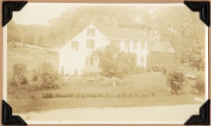
Here is a search of photographs of Carlisle MA on the site.  Below, are a number of photos I found that I had not seen before AND were Koford House at the corner of South Street and West Street Carlisle related.

the origin of these photos is the Wilkins Notebooks.

The Wilkins Notebooks – from DigitalCommonwealth  (also to be found from the Gleason Library site)

The items in this collection are drawn from “Old Houses and Families of Carlisle, Mass.,” a nuanced and detailed history of the town. This 25-volume set of notebooks was written and compiled by Martha Fifield Wilkins, who donated the series to the Gleason Public Library in 1941.Locally known as the Wilkins’ Notebooks, the twenty-five volumes provide extensive and unique documentation of Carlisle’s history. Throughout the 1930s, Carlisle resident Martha Fifield Wilkins researched houses in town built before 1830. She compiled the histories of these houses from deeds and other documents, family lore, and local history resources. Extensive genealogy is integrated with the house histories, including in-depth histories of selected families. Enhancing the histories of houses and people are colorful descriptions of community institutions, events, and traditions. Local folktales and unique anecdotes enliven the narrative.

Approximately 500 photographs are placed throughout the notebooks to compliment the text. Mrs. Wilkins included several photographs of each house, most of which were taken between 1900 and 1940, but also older images when available. The photographs provide researchers with a rich visual history of Carlisle’s past.

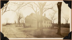
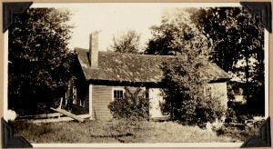
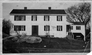
The Old Farrar Place, now residence of William C. Koford
Backside of the house - the photographer is standing in the middle of south street, approximately where the brook goes under the road.  Note, according to Alice Koford, the town of Carlisle was generally electrified in 1918 and the streets at this end of town were paved in 1938
Backside of the house – the photographer is standing in the middle of south street, approximately where the brook goes under the road. Note, according to Alice Koford, the town of Carlisle was generally electrified in 1918 and the streets at this end of town were paved in 1938.  The small outbuilding in the left hand side of the photograph I believe is the roof for what the Koford’s used/called their ice house.  There is some evidence however that this was a re-purposing of an existing underground structure created by the local native americans in pre-colonial times as a healing chamber.  This is based on its design and construction (triangular, steps built into the side) and location.  More to come on this
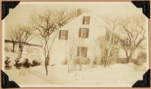
The Old Farrar Place, now residence of William C. Koford
The Old Farrar Place, now residence of William C. Koford.  Note in the far background, how clear the land is – this was where the chickens were on the old Larsen property (know as MacRae by us kids in the 1970s – owned by Inga Larson MacCrea)
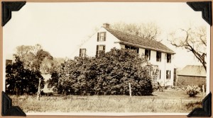
The Old Farrar Place, now residence of William C. Koford
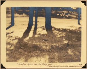
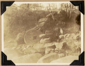
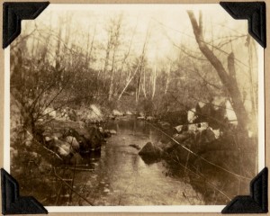
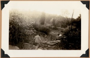
  EDIT – adding in some interesting additional photos about Carlisle water mills – all appear to be related to the Page Mill on the Greenough property (now a conservation town property).  My mill on Page’s Brook appears to have been in operation from 1660 to 1903 when it burned down and was originally associated with the Blood family.  It is mentioned in the Wilkins notebooks and other places, including maps, but I have yet to find anything very descriptive or photographic evidence from before it burned down.
relocated millstone as a decorative piece in landscaping
Old mill stones from the Page Mill at Greenough
Site of Page Grist Mill on Page Brook now on French-Greenough estate
Site of the old Adams saw and grist mill on River Meadow Brook- James H. Wilkins in foreground

Picture caption for above: In the year ending March 1-1867, the town of Carlisle paid C.E. Adams $14.39 for grinding grain

Hook Mill on Arthur Hall estate
Hook Mill on Arthur Hall estate.  Situated on River Meadow Brook.  Demolished 1935

Edited 5/25 for spelling errors, added some update data on photos above, and the photo below of the Cider Mill

Cider mill with fan window on Ricker farm.  Title from volume, page 2.
Picture caption: Erected by Humphrey Prescott.

Cider mill with fan window - carlisle


Old photos of the Koford property vs Today

I mentioned in this post here  that my parent’s had found some old photos that Alice Koford had taken and given them in the late 1960’s when they purchased the property on South Street in Carlisle.  The photos were taken post WWII but before the property was sold in the estate sale (as I recall, … Continue reading “Old photos of the Koford property vs Today”

I mentioned in this post here  that my parent’s had found some old photos that Alice Koford had taken and given them in the late 1960’s when they purchased the property on South Street in Carlisle.  The photos were taken post WWII but before the property was sold in the estate sale (as I recall, Alice’s mother passed away in 1941 without a will and the siblings were unable to work out the details for over 20 years – so the judge moved the estate into an estate sale.  Ben Benfield outbid Alice by some $15,000 for the full 150 acres and the house.  He broke up the property and sold the house and 5 acres to Alice, 5 acres to my parent’s and the remainder went into various conservation restrictions.  Some was sold to the newly formed Conservation Foundation (between our property and the Concord town line and Spencer Brook) and across Westford road up the hill along West Street – a conservation restriction)

Anyway – yesterday (Saturday) I took a camera tried to replicate the pictures as of present day.  That turned out to be a bit of a challenge for two reasons – first, that the apparent aspect ratio and lens field of view that Alice used was a bit different than what I have today.  I got pretty close though.  Secondly – traffic on a Saturday here is now significantly different than back then – standing in the middle of the street takes a bit more situational awareness and agility than I suspect that Alice needed to use during the first shots!  (for my brothers, this should be obvious, since we used to play up and around the street and the traffic in the ’70’s was pretty meagre compared today – and that had to be 20+ years after the original photos were taken.

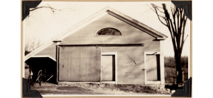
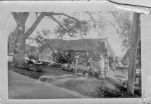
So – first up – the original picture of the barn at the top of our present driveway.  Note a couple of things

  1. The large elm tree on the left of the original picture was still alive when the property was purchased.  My mom says that all the elms on the property (4 large ones) all became stricken with Dutch Elm disease shortly there after and died.  The future stump of the elm became the left hand corner of our present drive way (give or take) – I recall it making left turns out of the driveway onto South Street to be a bit of a hassle.
  2. Some rocks in the stone wall are recognizable from both pictures
  3. It is unclear if the telephone pole in the photos is the same pole or not?  I am pretty sure it is NOT because the square relief cut on the earlier photo appears to be missing on the current pole.  So it is difficult to figure out the distances from the edge of the road on that side.  I seem to recall as a teen, that South Street was lower vs the grass than either photos show – because mowing around the pole was a bit tricky due to height differences.  Not sure how much that was or accurate that memory is
  4. the corner of the main stone wall currently is a 12’x12′ approximate square arrangement of stones.  It is difficult to say if that is present or not?
  5. The barn was gone when my parents bought the property.  My mom had the driveway guys fill in the cellar hole and foundation of the barn so we little kids would not fall into it.
  6. on the right hand side of the older picture is a hen house type structure (long and narrow and parallel to the present driveway.  My Mom recalls it containing a large stack of Wellesey College Alumni magazines along with other trash.  Everyone at the time thought that was very odd.
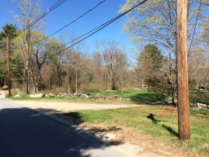
  7. New Picture stuff – the big tan rock?  that was buried and in the town ‘taking’ along the road and was a regular obstacle to snow plows and cars hitting it and breaking things – the town got sick of it sticking up so they pulled it out.  My dad convinced them to just move it onto our property since it was neat.
  8. New Picture – Additional.  This shows the backside of the area around the telephone pole because the squared stone work is not very visible in my current photo.
Photo of the old barn that used to be at the top of the driveway
May 2, 2015 picture of the top of the driveway.  Contrasted to the old Koford photo of the same location and angle
May 2, 2015 picture of the top of the driveway. Contrasted to the old Koford photo of the same location and angle
a view of the backside of the stone wall and telephone pole

The old Koford House, previous prior to that, the old Davis House.  Read more from the Wilkins Books online at the Gleason Public Library website for descriptions of this house that dates back to 1689 and other old houses in Carlisle, MA

A few things to note between old and new.

  1. Alice Koford told me that she planted a number of the trees along South Street and at the corner when she was a kid to block noise from the chickens that were on the old Hutchinsons/Larson’s property (next to our parent’s property)
  2. Simon Davis Jr.  built the house originally. John Davis lived there and practiced medicine.  Samuel Davis lived there for some time.  It appears that the Hutchinson’s owned it briefly (based on map).  This was sold to William Farrar (son of Steven Farrar and Lucy Davis) and the Hutchinson’s had the house next door (Spencer Brook Farm).  The deeds and documentation are a bit vague.  Ultimately, it was sold in 188o’s to William C Koford.
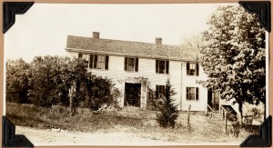
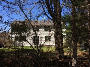
The front of the Koford house (across the street from the barn picture above).  This house, built in 1689 by Doctor Davis has a field stone foundation and when I was a kid, it still had corn cobs as insulation
The front of the Koford house (across the street from the barn picture above). This house, built in 1689 by Doctor Davis has a field stone foundation and when I was a kid, it still had corn cobs as insulation

IMG_0591

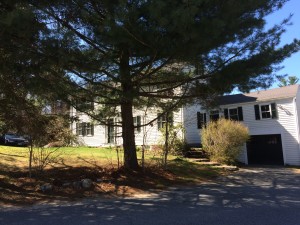
A better picture, even if it is at a different angle.  To the right is the carriage house with the driveway leading up to it.  The door from the driveway led to the kitchen and the old wood fired iron stove (4 holes).  Converted to oil at some point.  The front door was the traditional formal entrance to a Salt Box with the formal sitting room to the left of the door.  The stairs up were directly ahead.
A better picture, even if it is at a different angle. To the right is the carriage house with the driveway leading up to it. The door from the driveway led to the kitchen and the old wood fired iron stove (4 holes). Converted to oil at some point. The front door was the traditional formal entrance to a Salt Box with the formal sitting room to the left of the door. The stairs up were directly ahead.


The post where I do some bragging… About my Sister-in-Law

I think my whole family is just chocka-block full of great people – but today, I want to do a little timely bragging about my SiL Tenley. She started a photography business 3 years ago with a vision of combining good old hard work, professionalism, networking and business acumen with something she enjoyed and was … Continue reading “The post where I do some bragging… About my Sister-in-Law”

I think my whole family is just chocka-block full of great people – but today, I want to do a little timely bragging about my SiL Tenley.

She started a photography business 3 years ago with a vision of combining good old hard work, professionalism, networking and business acumen with something she enjoyed and was good at – photography.  I may mess some of this up – so all mistakes are mine – but the journey started with some technical photography classes and a camera.  Tenley is NOT the photographer you see wandering around with 65 pounds of lenses, $20,000 dollar camera bodies with a back pack, vest pack and belt packs – she uses her eye instead to get the shot she wants.

She has been both having fun and has steadily been building a profitable business with a diverse local clientele.  Till now that is, because she has broken out and gone national – as in National Geographic national !

One of Tenley’s photos caught Nat Geo’s eye while they were researching for their new book Abroad at Home:  The 600 Best International Travel Experiences in North America  The put two of her of her local photos in the book – including one on the cover!  The scallops on the cover is her photo.  They also included the iconic windmill that is the central touchpoint of her town – Solvang CA  (from wikipedia – the short explanation of what Solvang is – the attraction for Abroad at Home is a natural:  “Solvang was founded in 1911 on almost 9,000 acres (3,600 ha) of the Rancho San Carlos de Jonata Mexican land grant, by a group of Danes who traveled west to establish a Danish colony far from the midwestern winters. The city is home to a number of bakeries, restaurants, and merchants offering a taste of Denmark in California.”  

The Santa Ynez valley is a wonderful mix of earth, food and wine – old time ranches mixed in with new wineries and great weather.  That she got picked up to represent the local area is just great.  I am even more proud of her taking the opportunity that this represented and getting others involved – a book launch party with the local bookstore – The Book Loft  (where they sold a LOT of copies of the book) and an event with the restaurant (brain lock – I can’t remember their name – sorry!) where she did the scallops photo shoot – and other events as well – a whirl wind.

The book and her contribution has also been picked up locally and nationally

Good job Tenley (and faithful Igor/minion – Pete).  The fully rounded approach of craft and business is just great stuff.  Woot-Woot!

Oh – and I have a permanent plug to her website on the right bar of this blog – but here it is too:  http://www.tenleyfohlphotography.com/   (edit – I am getting WordPress errors for some reason – I have moved the links to the TOP of the blog while trying to remedy it.  No luck so far, but they are working again post move)

water driven mills of Oregon – posted some new video

As part of my drive across the country recently, I took a fair amount of video from the Thomson Mill in Shedd OR and the Thomas Kay Mill (Willamette Heritage Center in Salem OR). I realized this morning that I forgot to post most of that video – so I just uploaded them to YouTube … Continue reading “water driven mills of Oregon – posted some new video”

As part of my drive across the country recently, I took a fair amount of video from the Thomson Mill in Shedd OR and the Thomas Kay Mill (Willamette Heritage Center in Salem OR).

I realized this morning that I forgot to post most of that video – so I just uploaded them to YouTube and made a playlist.  There was a lot more working machinery at the Thomson Mill – so I that playlist has a lot more stuff in it.  At the woolen mill, I took a LOT of photos – but they still need editing and organization.  I will work on that next

links:

Thomson Mill – Shedd, OR  videos:  https://www.youtube.com/playlist?list=PLUAtYAIN3mnnHqhOnOAgOyJmyeB2qbOoW

Thomas Kay Woolen Mill – Salem, OR videos:  https://www.youtube.com/playlist?list=PLUAtYAIN3mnnSBRkJM0LEuHg0OHCMDBbH

Thomson Mill – state park website information in case you want to visit: http://www.oregonstateparks.org/index.cfm?do=main.loadFile&load=_siteFiles/publications/thompsons_mills.pdf

Thomas Kay Woolen Mill/Willamette Heritage Center website in case you want to visit:  http://www.willametteheritage.org/the_Thomas_Kay_Woolen_Mill.html

cheers and happy Easter everyone!

Nine days till the Red Sox home opener in the frozen tundra – errr – Fenway park

Spring is flirting with us but my thought this morning (Sunday) looking out was that things were still pretty frozen.  We got above freezing a very little bit today but the ground is frozen very, very hard still 22 days till the Sox home opener – could be a chilly one!  

Spring is flirting with us but my thought this morning (Sunday) looking out was that things were still pretty frozen.  We got above freezing a very little bit today but the ground is frozen very, very hard still

22 days till the Sox home opener – could be a chilly one!


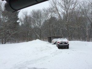
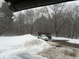
2 inches of snow falling in the tail end of winter - Friday March 20, 2015
2 inches of snow falling in the tail end of winter – Friday March 20, 2015
Sunday morning, the snow had melted away but back down below freezing again.   Frozen Tundra!
Sunday morning, the snow had melted away but back down below freezing again. Frozen Tundra!

Tramping around Spencer Brook, Carlisle MA

EDIT – so much for winter being on its way out – it has started bucketing snow here in the late afternoon.  We probably have an 1/8th or 1/4 inch already – whoops! Spring has not yet arrived, but Winter is definitely on its way out In Carlisle, this weekend the temperatures have been in … Continue reading “Tramping around Spencer Brook, Carlisle MA”

EDIT – so much for winter being on its way out – it has started bucketing snow here in the late afternoon.  We probably have an 1/8th or 1/4 inch already – whoops!

late afternoon on March 15, 2015 - so much for winter being on the way out the door - lol
late afternoon on March 15, 2015 – so much for winter being on the way out the door – lol
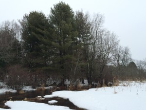
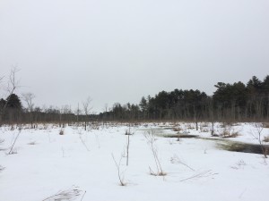
Open water has arrived in the last few days

Spring has not yet arrived, but Winter is definitely on its way out

In Carlisle, this weekend the temperatures have been in the low 30’s and it has been raining in a desultory way off and on all weekend.  I got a set of snow shoes for my birthday this year (thank you Marty & Allison!   They got them for me as part of my cross country drive emergency kit.  Fortunately they were not needed and in fact, the only place that really had snow is eastern Mass.)

I decided to try the snow shoes out before the season ended because the snow is starting to get pretty rotten and slushy.  Next to my parent’s property is Spencer Brook which is a slow moving brook and marsh land with a lot of streams feeding into it – in a slow meandering way.  The water level in recent years is up from when I was kid due to some beaver dam activity downstream.  Some years when I was kid, it was pretty dry – but not this year.

Good fun tramping around even with the overcast and light rain.  I only fell through into standing water once!  (turns out LL Bean boots retain water quite nicely if it pours in over the top – then they act like a Jacque Cousteau wetsuit once the freezing water warms up – lol!)

I saw quite a bit of animal track – many rabbits and in one area, what I think was a Coyote track – it was leaping along and belly flopping into the soft snow.  It clearly did not think much of this idea because it quickly looped back around to firmer ground.

Over near the fields along the road, there were cross country ski tracks and snow shoers like me – but their tracks were old.

It is definitely still winter but you can tell that it is on its way out – the ground is still frozen rock hard but mud is our future!

Spencer_Brook 426

Panorama along Spencer Brook


rowing shells and The Shop
Mud will be arriving at Fohlfield in Carlisle soon!