Made it to Carlisle

I pulled into Carlisle today after driving 4,343 miles in 9 days (including one very fun rest day in Solvang CA).  Woot!  a very fun trip but I am also pretty tired. I listened to 6 full Audio Books from Amazon’s Audible application – which was fantastic  – very engaging Old Man’s War – John … Continue reading “Made it to Carlisle”

I pulled into Carlisle today after driving 4,343 miles in 9 days (including one very fun rest day in Solvang CA).  Woot!  a very fun trip but I am also pretty tired. I listened to 6 full Audio Books from Amazon’s Audible application – which was fantastic  – very engaging

  1. Old Man’s War – John Scalzi
  2. The Ghost Brigades – John Scalzi
  3. The Last Colony – John Scalzi
  4. Zoe’s Tale – John Scalzi
  5. The Human Division – John Scalzi
  6. The Cosmic Computer – H. Beam Piper

They ran out about 2 hours before making it home – great timing!

Amazon’s John Scalzi author page – highly recommended

H. Beam Piper author page – an all time favorite of mine

Lots of snow here – by far more than literally anywhere I was going across country

I left the hotel around 7am this morning and managed to beat most of the traffic around Buffalo NY.  I noticed this morning that the many jet contrails in the sky looked like fractal frozen ice crystals on a window pane – a macro version of what they actually are way up there 😉

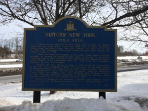
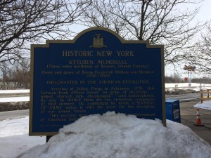
Driving was pretty straight forward and I was struck by the highway rest stops – much bigger and more trafficked than further west – which I guess is obvious – but NY has some interesting history along route that they point out.  The I-90 travels quite a bit alongside a number of historic canals, including the Erie Canal – which I did not get a photo of unfortunately – since it was all frozen over and not very obvious under the snow.  All across the country, I found rest stops which had interesting things to show and to say and to teach – along with a place to use the rest room and maybe grab a cup of coffee.  I am glad people have gone to this effort – it is kind of neat!

New York I-90 rest stop information.

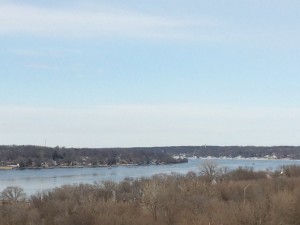
I made it to Concord MA before travelling the last 5 miles or so of the trip and I decided to stop at Minute Man National Park to bookend the trip.  Despite the mud (it has been cold but the temps shot up today to 54 degrees) and snow, there were a number of people walking around and the Old North Bridge was fully plowed out and accessible.  The Concord River is still frozen over and has lots of Nordic Ski tracks and animal tracks on it – not something you get every winter.

If you would like to learn more about this historic area – literally a walkable distance from my house – I suggest checking out the wikipedia link here

I remember when I was a kid and President Ford came out in 1975 on the 200th anniversary of the battle and dedicated the site as a National Monument (it latter got upgraded to Park status) – tens and tens of thousands of people were on hand to participate and watch.  This was on Patriots Day – April 19th, 1975

I still collect the Bicentennial Quarters when I can find them – they have the Minute Man statue on them and I like to think about all the hands they have passed through since 1975 and what the people thought about when they looked at them.  A surprising number are still in circulation 40 years later.

One of the things that I take away from this site, every time I visit, is the positive value of forgiving and not letting the past to prevent you from making new friendships.  After the War of 1812 between the United States and Britain, relations got better and have been productive ever since.  An important lesson

Anyway – enough of that – I hope anyone who is reading this has enjoyed my tripography (not a real word I am sure!).  I have a few more days of vacation before back to work in our Boston office – I will be doing some shoveling between now and then I am sure!
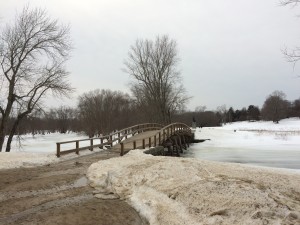
The Old North Bridge across the Concord River.   The National Park preserving the location of the second battle of the American Revolution and the location of what became known as "The Shot Heard Around the World..."
The Old North Bridge across the Concord River. The National Park preserving the location of the second battle of the American Revolution and the location of what became known as “The Shot Heard Around the World…”
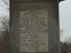
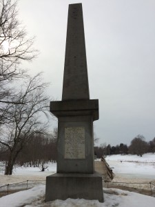
The monument at the Old North Bridge, erected on the 60th anniversary of the Declaration of Independence and the 61st anniversary of the battle.
Closeup of the inscription on the monument.  An interesting look into the mindset and memory of that time
Closeup of the inscription on the monument. An interesting look into the mindset and memory of that time
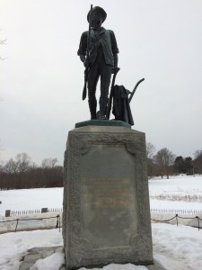
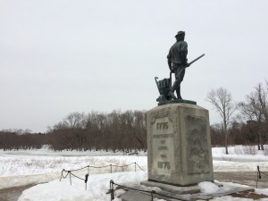
The Minute Man - the statue erected for the Centennial anniversary of the battle in 1875.  Crafted by Daniel Chester French, it contains the quote from Ralph Waldo Emersons' famous poem - the "Concord Hymn" By the rude bridge that arched the flood, Their flag to April's breeze unfurled, Here once the embattled farmers stood And fired the shot heard round the world
The Minute Man – the statue erected for the Centennial anniversary of the battle in 1875. Crafted by Daniel Chester French, it contains the quote from Ralph Waldo Emersons’ famous poem – the “Concord Hymn”
By the rude bridge that arched the flood,
Their flag to April’s breeze unfurled,
Here once the embattled farmers stood
And fired the shot heard round the world
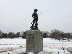
Picture of the statue - which is on the west bank of the river - looking up towards the pasture where the Concord and surrounding town's Militia were arrayed for the battle
Picture of the statue – which is on the west bank of the river – looking up towards the pasture where the Concord and surrounding town’s Militia were arrayed for the battle
Looking east across the river  Note the symbolism - the Minute Man has draped his coat across his plow and taken up his flintlock musket - which was ready to hand
Looking east across the river
Note the symbolism – the Minute Man has draped his coat across his plow and taken up his flintlock musket – which was ready to hand
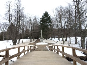
The crown of the bridge looking towards the original monument, which was erected on the site where the British regulars - "Red Coats" were deployed
The crown of the bridge looking towards the original monument, which was erected on the site where the British regulars – “Red Coats” were deployed
Panoramic from the Old North Bridge, Concord MA


Stressful traffic

Not much of an update today unfortunately that is super interesting. I headed out early from Peru IL and I have set down for the night in Hamburg, New York after passing through the remainder of Illinois, Indiana, Ohio and Pennsylvania. Roads were bad, traffic was bad, drivers were idiots and there were State Troopers … Continue reading “Stressful traffic”
Not much of an update today unfortunately that is super interesting.

I headed out early from Peru IL and I have set down for the night in Hamburg, New York after passing through the remainder of Illinois, Indiana, Ohio and Pennsylvania.

Roads were bad, traffic was bad, drivers were idiots and there were State Troopers everywhere.  I got pulled over and was given a speed ticket warning by the Illinois State Police while I was squinting through the morning sun trying to decipher the maze of merges and exits between Chicago and Gary Indiana – they were playing with the speed limit around there and I didn’t notice that it had dropped from 65 mph to 55mph.  Fortunately I was doing only 9 mph over the limit and he only gave me a warning – but I am pretty sure he pulled me out of line due to my out of state plates since I was being passed by locals at the time – that 1 mph was probably a disappointment to him.  Anyway, after I got through that I was careful to drive the speed limit till I hit the state line  – which is where the idiot truck drivers were blowing their air horns at me – for driving right on the speed limit – which apparently annoyed them tremendously even though I was on the right lane.  Not a big deal but still annoying

Last time I passed through Gary Indiana, Cleveland Ohio and the rest of the rust belt – it was really rusty – back in the eighties, I lost track of the number of rusted out mufflers and body panels that had fallen off vehicles and were littering the break down lanes.   This time through there wasn’t any of that – but I suppose the snow plows had taken care of them.  The road was still terrible except for the turnpike which was merely bad.  Nice rest stops though.

Needless to say, the roads in New York state are way better already than Illinois, Indiana OR Ohio.

I didn’t see anything worth taking a picture of – except the ice covered Lake Erie – but of course that was visible from the Interstate for only about 150 yards and was by before I knew it – so I pulled a shot from the web that looks very similar.  The wind had been pushing the ice, just like below, up into jagged pressure ridges – definitely not ready for pond hockey!

Hamburg is in a western suburb of Buffalo NY – so tomorrow it will be a straight shot through the middle of NY state and on to Massachusetts.  I will try and get some good pictures to wrap the trip up if I can find them

cheers!

Making time through Iowa

Absolutely gorgeous sunrise this morning while on the road.  Even though I took my time with the hotel breakfast, I set out this morning while it was still fully dark.  I managed to pull over and get a great shot of the sunrise. It was a bit cooler this morning than yesterday but still above … Continue reading “Making time through Iowa”

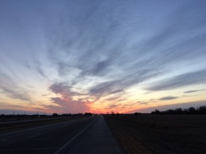
Absolutely gorgeous sunrise this morning while on the road.  Even though I took my time with the hotel breakfast, I set out this morning while it was still fully dark.  I managed to pull over and get a great shot of the sunrise.

Pre-dawn light from roadside of Interstate 80 heading east out of Gothenburg NE

It was a bit cooler this morning than yesterday but still above freezing.  As I am continuing to head east, I am seeing more snow on the ground – in shaded places only however

I trekked across Nebraska, all of Iowa and into Illinois (I am staying the night in Peru IL).   Iowa was a bit non-descript – but I did notice, almost belatedly, that there is a truly staggering amount of wind turbines in stretching from Wyoming through Nebraska and at least 1/2 across Iowa.  Not everywhere of course – but so many that I stopped noticing them – and they are truly VERY big – each blade is several hundred feet in size (picture below).  I didnt realize how big till I passed a rest stop (on the other side of the highway unfortunately – so no picture) and they had a single blade standing on end – it completely dwarfed the visitor center.

According to Wikipedia, Iowa has about 5 Gigawatts of wind generation capacity – as of two years ago.  That is a staggering amount of sporadic inputs into the state’s power grid.  Power grids are not static things – the current flow is exactly that – a current.  Dumping in power input that ramps up and down like wind at that level must be fiendishly complicated.   Maybe instead of the world’s biggest ball of string, they have invented the world’s largest and fastest spinning fly-wheel?

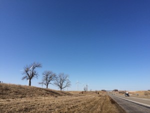
Not a great picture but I didn't think to stop earlier - this is looking back west along I-80 in Iowa.  The number of very large wind turbines along the interstate is absolutely staggering - this is only a small sample (these turbines are probably over 1 mile away - the blades are truly big!)
Not a great picture but I didn’t think to stop earlier – this is looking back west along I-80 in Iowa. The number of very large wind turbines along the interstate is absolutely staggering – this is only a small sample (these turbines are probably over 1 mile away – the blades are truly big!)

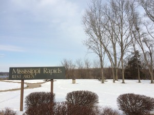
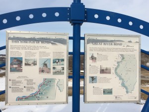
Iowa apparently does not care too much about the Mississippi River – I was on the bridge over the river before there was a road sign indicating what was going on.  Fortunately Illinois did it a bit better – they had a whole overlook rest area dedicated to it.   The rest area itself was neat architecture but my picture of it didn’t come out well at all – oh well

I should be passing by Chicago (not very close to Chicago actually) and Cleveland tomorrow.  I-90 and I-80 merge at Chicago and I plan on taking I-90 when the split up again.  Based on the mileage, I will probably be in Carlisle in 2 more road days – or 3 if the weather turns bad (knock on wood)

Iowa 009

Mississippi river - formerly a rapids area but there are now a number of downstream dams and locks which have smoothed things out on this leg of the river
Mississippi river – formerly a rapids area but there are now a number of downstream dams and locks which have smoothed things out on this leg of the river
Not as interesting or informative as the signs in Wyoming, but still worth posting


A day of contrasts…

Today I started in Evanston WY which is the farthest western part of the state (about 4 miles from the Utah border) and tonight I am in Gothenburg Nebraska. The day started out with temperatures in the teens at sunrise as I got on the road and stayed in the twenties pretty much all through … Continue reading “A day of contrasts…”

Today I started in Evanston WY which is the farthest western part of the state (about 4 miles from the Utah border) and tonight I am in Gothenburg Nebraska.

The day started out with temperatures in the teens at sunrise as I got on the road and stayed in the twenties pretty much all through the trip across Wyoming.  There has been a LOT of new resource extraction activities that have come in since the last time I was through here (admittedly back in 1985).  I passed at least a half dozen refineries along the highway – big ones.  They looked like they were converting coal into oil?  I also passed a big mine that had a lot of these trucks zooming around

Additional things – I managed to cross the Continental Divide TWICE.  I am not totally clear how I managed that one as I was heading east the whole time.  Seems like a bit of an oxymoron?  The signs quoted an altitude of about 4900 and 6000 feet independently of each other – weird.

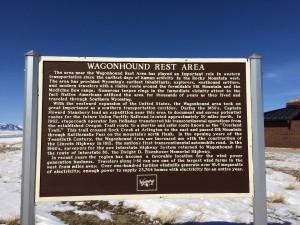
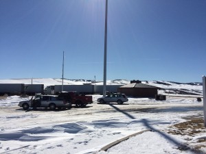
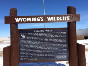
I stopped at the Wagonhound Rest Area in Wyoming since I was having a hard time finding a place to get some good photos – turns out it is a very interesting area (double click the photos below to read the signs).  Very scenic too and evocative of the far west in winter!

Wagonhound Rest Area - you definitely could see that the wind has been blowing hard around here - all the snow fences had deep drifts behind them (downwind)
Wagonhound Rest Area – you definitely could see that the wind has been blowing hard around here – all the snow fences had deep drifts behind them (downwind)
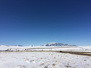
The highway shoots the gap between a number of mountain ranges - which you can see here
The highway shoots the gap between a number of mountain ranges – which you can see here

A panoramic photo of the same area – note the snow fences

Panoramic shot of the scenery at Wyoming rest stop

The rest stop had a fair amount of people when I was there but from the amount of snow in the parking lot, that was not typical

Wyoming rest area - very cool and dry - around 22 degrees Farenheit
Wyoming rest area – very cool and dry – around 22 degrees Fahrenheit
Interesting info about the general area around the Wagonhound Rest stop
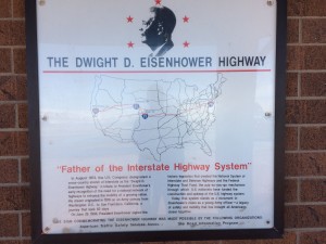
Interesting information on the interstate system - while I was aware this was something that Eisenhower pushed through, I thought it was more influenced by the Germany Autobahns and the need for ad-hoc runways in case of Soviet atom bombs - but apparently, he had been thinking along these lines for a long time...
Interesting information on the interstate system – while I was aware this was something that Eisenhower pushed through, I thought it was more influenced by the Germany Autobahns and the need for ad-hoc runways in case of Soviet atom bombs – but apparently, he had been thinking along these lines for a long time…

Crossed into Nebraska without problems and cruised along nicely – then I looked down and noticed it was 60 degrees.  This was about when I crossed the time zone from Mountain to Central time.  The temperatures have leveled out in central Nebraska to about 65 degrees Fahrenheit.  Very different from Wyoming which was stubbornly cold all day.  The jetstream must be blasting hard and doing a full push up from the Gulf of Mexico?

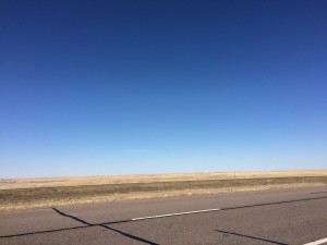
Road side on I-80 in western Nebraska - march 7, 2015 In a word - pretty flat.  The middle of the state actually gets a bit rolling and has a lot of water along the highway but out here it is the flat prairie
Road side on I-80 in western Nebraska – march 7, 2015
In a word – pretty flat. The middle of the state actually gets a bit rolling and has a lot of water along the highway but out here it is the flat prairie

While I was unloading the car today at the hotel, several hundred, if not a thousand, Snowy Canada geese flew overhead.  Lots of mixed V formations and a bit of confusion on their part.  I wonder if we are on part of their ‘fly way” ?

Pretty much it for today – enjoy the call of the wild below!

Crossing the high (and dry) plains

Today was about making miles. As you can see from the pictures below, things were pretty flat.  I went from La Grange OR this morning, through the remainder of Oregon, across Idaho (speed limit 80 mph by the way for cars), across Utah and about 4 miles into Wyoming to Evanston WY.  Which means I … Continue reading “Crossing the high (and dry) plains”

Today was about making miles.

As you can see from the pictures below, things were pretty flat.  I went from La Grange OR this morning, through the remainder of Oregon, across Idaho (speed limit 80 mph by the way for cars), across Utah and about 4 miles into Wyoming to Evanston WY.  Which means I can have beer with dinner unlike in dry Utah – after a long day, it will be very welcome.

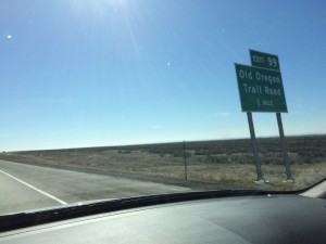
Lets see – some of the things I saw along the way today?  I passed over the old Oregon Trail wagon train route – I am not following the classic route as I am jumping back to the high plains by going through Wyoming.

I passed but decided not to stop at the Golden Spike Point historic site (the gold spike for the joining of the transcontinental railroad across the US).  There was no particular indication how far off the highway it was and how interesting can a stretch of railway track be – regardless of how significant it was to the economic development of the country?

Other things – I passed by an airbase in Idaho which had lots of Air Force A-10 Thunderbolts (aka – Warthogs) flying around with several F-18 jets – which I assumed where probably US Marine Corps jets – since the A-10 is a ground attack aircraft and they were probably doing joint service ground attack exercises.  The Navy flies the F-18 Hornet as well but I couldn’t think of a good reason for the Navy to be flying in northern Idaho however.

Not a lot of pictures today – but here are some, in chronological order to give you an idea of how the terrain is changing – from flat and dropping off table lands to the arid high plains.

Fun trip so far and the weather has been good so far – I hope it holds out well.

Nick

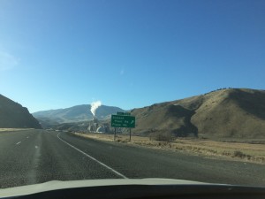
an interesting and elaborate Cement factory along I-84 in eastern Oregon
Eastern Oregon - Interstate 84 follows and crosses the old Oregon Trail wagon train route
Eastern Oregon – Interstate 84 follows and crosses the old Oregon Trail wagon train route
Heading down to the Snake River from the very flat eastern part of Oregon and into Idaho
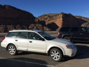
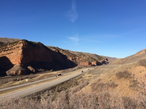
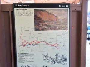
The trusty steed at Echo Canyon rest stop in Utah - closing in on the Wyoming border and I needed to walk around a bit
The trusty steed at Echo Canyon rest stop in Utah – closing in on the Wyoming border and I needed to walk around a bit
Looking east down the highway from the Echo Canyon rest stop

wyoming-border-2015 018

Further mill action

Better WiFi than I expected in the hotel – I was able to upload a video from each visit to my YouTube channel.  Now – time for breakfast and hit the road!    

Better WiFi than I expected in the hotel – I was able to upload a video from each visit to my YouTube channel.  Now – time for breakfast and hit the road!


Mills of Oregon around Salem

I was able to spend almost 3 hours today at the other two mills on my list – Thomson Mill and Kay Woolen mill I was able to take a private tour at both (mostly because I was the only one there at tour start time).  Both sites have absolutely fantastic tours and I took about … Continue reading “Mills of Oregon around Salem”

I was able to spend almost 3 hours today at the other two mills on my list – Thomson Mill and Kay Woolen mill

I was able to take a private tour at both (mostly because I was the only one there at tour start time).  Both sites have absolutely fantastic tours and I took about 130 photos and videos.  I won’t try and upload all of that with my Best Western hotel WiFi – below are a few select photos from both.

(edit – I just previewed this and the photos just don’t do either of these places justice but the videos are more evocative – hopefully I will be able to upload them soon – Nick)

The Thomson Mill was built and operating approximately a year ahead of Oregon becoming a state.  When the property was purchased, the land cost was $50 dollars and the water rights were $75.  This turned out to be important as the mill maintained the oldest and therefore most senior water rights on the river near Shedd Oregon – and the river sometimes would run dry in the summer.  The state bought the mill a few years ago to partly secure the water rights and make more productive usage (restoring steelhead and chinook spawning grounds due to demolition of various dam structures and also providing agriculture more water in dry years).  The steelhead and the chinook population has gone up 10x since 2004.

The mill itself was an absolute work of practical genius – packing in as much customization as was possible for different types of grain grinding, types of grinding etc…  The 3 water turbines powered a 4 story rube goldberg of chutes, pipes with internal augers for transport of grain and belts.  I would estimate over 100 different chutes where available to route grain around the building.  Fascinating place finally over come by the giant agriculture firms

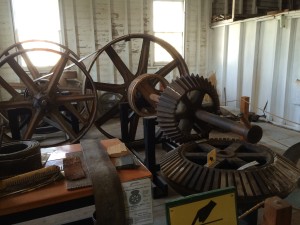
display of the king gear coming up from the vertical access turbine below the mill - with wooden teeth and the horizontal shaft with iron gears.  Wooden teeth are cheap, easily replaced and with break if something jams in the mill works - a built in planned weak spot
display of the king gear coming up from the vertical access turbine below the mill – with wooden teeth and the horizontal shaft with iron gears. Wooden teeth are cheap, easily replaced and with break if something jams in the mill works – a built in planned weak spot
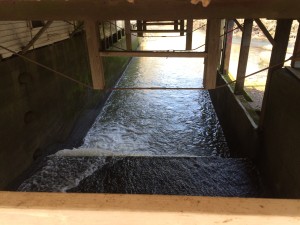
The mill race under the mill - while the water is not really flowing
The mill race under the mill – while the water is not really flowing
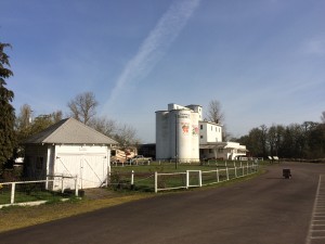
the mill itself - note the silos - they were the first concrete silos in Oregon and the interior of the cloverleaf of 4 silos was also another silo - very thrifty of material
the mill itself – note the silos – they were the first concrete silos in Oregon and the interior of the cloverleaf of 4 silos was also another silo – very thrifty of material

Kay Woolen mills was also a great place – their turbine system was very powerful and generated enough oomph to power all the mill machinery AND 200 watts of electricity to power the 100 lightbulbs (20 watts) throughout the mill.  Built slightly later than Thomson (i will have to look up the date latter), mill we can visit today is the second mill – the first one burnt down 7 years after originally being built.

The mill employed 1/5 of the people around Salem OR and a giant majority of the non-farm population.  The mill owners were very family oriented – all the children worked in the mill and knew how to do every job.  A bit of a dispute with the family caused a portion of the family to branch off and take over a defunct mill in Pendleton OR  – the famous Pendleton Mills which is still going strong (they had french looms which could take the smaller fibers needed for weaving synthetics in the late 1950’s and early 1960’s) http://www.pendleton-usa.com/

I noticed a lot of the machinery at Kay was manufactured in Massachusetts – the mill tour guide was very interested to find out that I was from a town near Lowell MA – he was an old mill mechanic and had vacationed in MA to visit the old mills in Lowell.

The mill itself was very much more purpose built and designed for high volumes of a more narrow product set than the Thomson mill – so it was much more structured.  Fascinating stuff – during the demonstration of one of the power looms, it wove about 1/2 an inch in 20 seconds and apparently that is slow – more modern mills would do about 4x of that.  The shuttle that zooms back and forth apparently on this loom took the trip 3 times per second – originally the shuttle was walnut – the one they were using for the demo was a vintage Bakelite model

Great stuff – I will link and post up more when I have the opportunity.

Oh  – and where am I now?  I am in La Grande OR on Interstate 84 going east – so getting near the Idaho border.  I tried to stay in Pendelton OR – but there was some giant school state basketball championship going on and all the hotels were booked – i had to drive another 45 miles further (but I got smart and booked a room on the phone at that point since there was a stream of other travellers looking for rooms!)

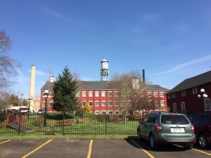
The Kay mill in Salem from the parking lot - a big building
The Kay mill in Salem from the parking lot – a big building
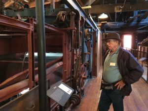
One of the giant carding machines from getting the raw wool ready for spinning to thread
One of the giant carding machines from getting the raw wool ready for spinning to thread – Bill the Guide was great and very, very knowledgeable – he had worked in mills his whole life – including playing around them as a kid and getting chased out by the foremen!
One of the vintage machines on the carding floor

Moving through northern California to Oregon

Finally broke free of the greater bay area traffic today.  I spent the night in Santa Rosa visiting with family – I had a great time playing with my two nephews  (minecraft and Top Gear videos on YouTube with one – tickling and playing peek-a-boo with the other) I managed to stop and take some … Continue reading “Moving through northern California to Oregon”

Finally broke free of the greater bay area traffic today.  I spent the night in Santa Rosa visiting with family – I had a great time playing with my two nephews  (minecraft and Top Gear videos on YouTube with one – tickling and playing peek-a-boo with the other)

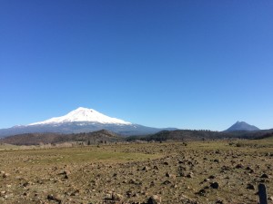
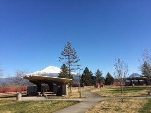
I managed to stop and take some photos of Mt Shasta  – it was a such a clear day – see the photos below.

I was barely able to make it to the first mill on my list – in Eagle Point OR (see below).  I arrived a few minutes after their official closing time but they were still hanging around.  I was able to convince them to sell me a DVD on the mill and its operation, along with some stone ground corn muffin mix, pancake mix and cookie mix!  I also picked up a home made ginger cookie – it was great!

I had a short talk with the owners about their mill and they turned me on to the Society for Preservation Of Old Mills  (www.spoom.org) – I haven’t taken too much of a look at it tonight but will check it out definitely

I am having a great time and the scenery is beautiful

Mount Shasta showing the snowy cap - taken from the shoulder of Highway 5
Mount Shasta showing the snowy cap – taken from the shoulder of Highway 5
A Pano from the shoulder of Highway 5 of Mt. Shasta
A rest stop looking at Mt. Shasta

Puttering around Solvang, CA with family

I spent the day, yesterday (3/2/15), with my Sister-in-Law out and around Solvang, CA.  We went to a great lunch place  – Industrial Eats in next door Buellton.  We had a great pizza and salad (plus take home prosciutto and a baguette).  Very fun place! The weather yesterday was on again/off again but with neat clouds. … Continue reading “Puttering around Solvang, CA with family”

I spent the day, yesterday (3/2/15), with my Sister-in-Law out and around Solvang, CA.  We went to a great lunch place  – Industrial Eats in next door Buellton.  We had a great pizza and salad (plus take home prosciutto and a baguette).  Very fun place!

Wood fired ovens at Industrial Eats
The steam / cowboy punk industrial espresso machine

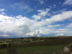
The weather yesterday was on again/off again but with neat clouds.  Tenley took us over to a new client’s winery to see if the light worked for some photos the winery wanted taken (name with held for pub launch purposes!).  She used her full rig – I used my iPhone 🙂

a neat place and a great location – Happy Valley Road – Santa Ynez Valley.

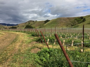
newly planted vineyard
Hilltop looking east from Happy Canyon
Panoramic
Panoramic

How to make negative forward progress but still have fun

If you are reading this blog, you probably have figured out that I am intending on making my way across the country from San Francisco along the northern part of the country via Oregon and Idaho. So of course, I am taking the ‘direct’ route and immediately headed south to visit family – in Solvang … Continue reading “How to make negative forward progress but still have fun”

If you are reading this blog, you probably have figured out that I am intending on making my way across the country from San Francisco along the northern part of the country via Oregon and Idaho.

So of course, I am taking the ‘direct’ route and immediately headed south to visit family – in Solvang CA  (Pete and Tenley).  The drive down was easy, but I did get hit with sporadic showers, heavy down pours and one time really heavy hail which slowed traffic on the Interstate down to a crawl – I was able to see over an inch of ice accumulation on the road – then “poof” and we came through the other side.  Any rain at this point in California is welcome but I don’t think the sporadic nature of this particular storm will put much of a dent in the drought.

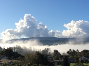
Photo below is of the morning fog here in the Santa Ynez Valley – a great way to greet the morning with a cup of coffee!

looking south down towards the Santa Ynez River - early morning marine layer fog and quickly building cumulus clouds (possibly building to cumulonimbus latter in the day?)
looking south down towards the Santa Ynez River – early morning marine layer fog and quickly building cumulus clouds (possibly building to cumulonimbus latter in the day?)